Powered by Airspace Link in Partnership with the FAA and the City of Southfield
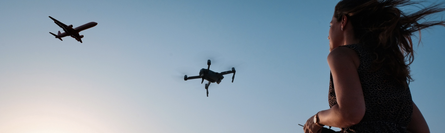
Flying Your Drone Safely in the City of Southfield
The City of Southfield supports the safe, respectful, and legal use of drones in our community - for recreation, education, and innovation.
The FlySafe initiative provides residents, visitors, and businesses with up-to-date information on where and how to operate drones safely.
Here, you’ll find tools, resources, and local information to help you plan safe flights in accordance with Federal Aviation Administration (FAA) rules.
For details on certifications, operational guidelines, and authorizations, visit the FAQ & FAA Resources section below.
Why FlySafe?
The FlySafe program empowers the community to:
- Understand where drone operations are permitted or restricted.
- Access local advisories and event notifications.
- Plan flights with accurate, real-time risk and airspace data.
- Operate safely in compliance with FAA regulations.
Through Airspace Link’s AirHub® Portal, pilots can view safety advisories, check local conditions, and request FAA flight authorizations within minutes.
Note: Southfield FlySafe does not capture personal information or live video. All displayed data is sourced from the FAA and City-approved systems.
Interactive Map: See Where It’s Safe to Fly
Use the interactive map below to explore Southfield’s airspace. View local advisories, restricted zones, and FAA charts - all in one place. This tool informs of where drone flights are permitted, restricted, or require authorization. Areas are color-coded to reflect different airspace rules. Click on the map for more details and always confirm your flight plan using FAA-approved tools.
Powered By Airspace Link
For Commercial or Advanced Drone Operations
For drone delivery, Unmanned Aircraft Systems (UAS) operations, or Advanced Air Mobility (AAM) infrastructure and support in the region:
Contact the City of Southfield
For program participation, data sharing, or operational permissions.
Public Safety contact, Sgt. Michael Morrish
Email: MMorrish@cityofsouthfield.com
Phone: (248) 796-5396
Contact Airspace Link
For enterprise tools, integrations, or training with AirHub® Portal and FLYSAFE systems.
Email: info@airspacelink.com
Website: https://airspacelink.com
How Pilots Can Get Started
Step 1: Confirm Certifications
Ensure you have a valid FAA TRUST Certificate (recreational) or Part 107 Remote Pilot Certificate (commercial).
Step 2: Register Your Drone
All drones weighing more than 0.55 lb must be registered with the FAA.
Step 3: Create a Pilot Account
Register as a drone pilot in the AirHub® Portal. Once registered, you’ll have access to up-to-date airspace information and can submit flight authorization requests through LAANC.
Step 4: Plan Your Operation
Locate your flight area using an address, coordinates, or the interactive map. Define operation details such as altitude, start time, and flight area.
Step 5: Request FAA Authorization
Submit your request AirHub® Portal for near real-time FAA approval to operate in controlled airspace under 400 feet.
FAQ & FAA Resources
FAA TRUST Test (Recreational Pilots)
The Recreational UAS Safety Test (TRUST) is required for all recreational drone pilots in the U.S. It ensures pilots understand basic safety and airspace rules before flying. The free online test can be completed in about 30 minutes through FAA-approved providers.
- Take the free online training to obtain your TRUST Certificate: https://www.faa.gov/uas/recreational_flyers/knowledge_test_updates
Part 107 Certification (Commercial Pilots)
Commercial drone pilots must hold a Part 107 Remote Pilot Certificate issued by the FAA. This certification demonstrates that the pilot understands national airspace classifications, weather impacts, and operational limitations for safe flight. Testing is available at FAA-approved testing centers nationwide.
- Learn how to become a certified FAA Remote Pilot: https://www.faa.gov/uas/commercial_operators/become_a_drone_pilot
Part 108 (Advanced Operations)
The FAA’s upcoming Part 108 rule will provide the framework for Beyond Visual Line of Sight (BVLOS) and other advanced drone operations. It builds upon Part 107, enabling more complex commercial and public safety missions such as delivery or infrastructure inspection. This rule is still in development but will mark a major milestone in advanced air mobility.
- Learn about the upcoming FAA Part 108 framework for Beyond Visual Line of Sight (BVLOS) and advanced drone operations: https://www.flyusi.org/blog/part-108-bvlos-uas-workforce-standards
LAANC – Low Altitude Authorization & Notification Capability
LAANC is the Low Altitude Authorization and Notification Capability, a collaboration between FAA and Industry. LAANC provides near real-time approval for drone flights in controlled airspace under 400 feet. Pilots can use authorized applications—like Airspace Link’s AirHub® Portal—to request FAA LAANC authorization digitally in seconds. It’s available at hundreds of airports across the U.S.
- Instant FAA airspace authorizations for flights in controlled airspace: https://www.faa.gov/uas/getting_started/laanc
B4UFLY
The FAA’s B4UFLY service shows where recreational flyers can and cannot fly. The FAA has approved five companies to provide B4UFLY services through desktop and mobile applications, such as Airspace Link’s AirHub® Portal. B4UFLY provides situational awareness to recreational flyers and other drone users, such as guidance on restricted areas, temporary flight restrictions (TFRs), and controlled airspace boundaries before takeoff.
- Check where you can and cannot fly: https://www.faa.gov/uas/getting_started/b4ufly
TFRs – Temporary Flight Restrictions
Temporary Flight Restrictions (TFRs) are areas where drone flights are temporarily limited or prohibited, often due to large events, disasters, or national security operations. Checking for active TFRs before every flight helps pilots avoid fines or enforcement actions.
- Check for restricted areas or special events: https://www.faa.gov/uas/getting_started/temporary_flight_restrictions
FAA DroneZone
The FAA DroneZone is the official portal for registering your drone, renewing pilot certificates, applying for waivers, and managing operational approvals. It’s the central online hub for all FAA drone compliance activities.
- Register your drone, manage pilot certificates, and apply for waivers: https://faadronezone-access.faa.gov/
UAS Facility Maps
The UAS Facility Maps show FAA-approved grid areas that indicate the maximum altitude allowed for automated authorization requests. Pilots can reference these maps to understand where flight requests will likely be approved instantly through LAANC.
- View FAA-approved grid maps to determine altitude limits for authorization: https://www.faa.gov/uas/commercial_operators/uas_facility_maps
Quick Facts for Pilots
- Remote Pilot Certificate: Obtain by passing an FAA knowledge test (or online course for Part 61 pilots).
- Aircraft Weight: Must be under 55 lbs (25 kg) to operate under Part 107.
- Altitude Limit: Max 400 ft AGL (unless within 400 ft of a structure).
- Speed Limit: Max 100 mph (87 knots).
- Visual Line of Sight: Drone must remain within unaided sight; one pilot per drone.
- Daylight Operations: Daylight or twilight only (30 min before sunrise / after sunset) with anti-collision lighting.
- Night Operations: Allowed if pilot has completed night-flight training and anti-collision lights are used.
- Operations Over People: Permitted if drone meets FAA category requirements.
- Controlled Airspace: Requires LAANC or FAA authorization, even below 400 ft.
Contact
For general inquiries or to report drone-related concerns, please contact:
Business Development
Rochelle Freeman, rfreeman@cityofsouthfield.com (248) 796-4161
Sarah Mulally, smulally@cityofsouthfield.com (248) 796-4162
For platform or technical support, please contact:
Airspace Link Email: info@airspacelink.com