Coasting the Baseline Obelisk Project

Content

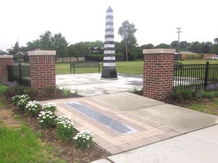
The Coasting the Baseline Project is a series of commemorative markers located on Eight Mile or Baseline Road.   Each marker is a ten foot tall obelisk that describes the significance of surveying in the settlement of Michigan and as the foundation for property ownership in the state. Michigan was the first state in the nation to be fully surveyed using modern surveying practices. Known as the Public Land Survey System (PLSS) or the rectangular survey system, it is a mathematically designed and based method of measuring land.  

The Southfield Coasting the Baseline Obelisk, completed in May 2016, has joined those of other neighboring communities along Eight Mile Road.  It is envisioned that markers will stretch from Lake St. Clair to Lake Michigan along the baseline. The markers, designed by Michigan native and world-renowned sculptor David Barr, include engraved references to early surveying tools, land ownership in America and elements of each community’s local history and are made from alternating blocks of black and white granite. The obelisk shape was chosen because it was commonly used by early surveyors to mark significant geographical points. The site selected for Southfield’s Coasting the Baseline marker is at Eight Mile and Rutland on city owned property.  The Southfield Coasting the Baseline Obelisk was erected entirely through private and corporate sponsors.  No public monies were used for this community project.